Topographic Site Plans in Portugal
Precision site plans created using high-resolution drone mapping and aerial surveying
Drone Mapping & Topographic Site Overview
Every site has its own logic — shaped by terrain, elevation, and the natural movement of the land. Understanding these conditions is essential before meaningful design decisions can be made.
Our Topographic Site Plans are created using professional drone mapping and aerial surveying to deliver a precise, design-ready understanding of existing terrain. Serving projects across Portugal, we capture accurate elevation data, contours, and site conditions to produce build-ready plans for pool construction, landscape design, and site planning — faster and less invasive than traditional ground surveying.
What’s Included
Each Topographic Site Plan may include:
Existing conditions site plan (bird’s-eye view of current site context)
Measured elevation contours at appropriate intervals
Terrain hillshade for slope and drainage clarity
Elevation analysis (height-based visualization)
Measured distances, areas, and elevation differences
Printable A1 or A2 site plan (PDF)
Digital files for review and coordination
Optional 3D terrain model
Exact deliverables vary based on site size, terrain complexity, and project needs.
Topography influences every major design decision — from layout and access to grading, drainage, and construction feasibility. Without accurate terrain data, early design assumptions often lead to revisions, inefficiencies, or unnecessary cost later in the process.
By establishing a reliable topographic base at the outset, design decisions can respond naturally to the land rather than forcing solutions onto it.
Why Topography Matters Early
What This Service Provides
This service delivers a complete terrain analysis package in multiple usable formats, supporting early planning, feasibility and design decisions.
Site layout and spatial planning
Grading and elevation studies
Section, slope, and level analysis
Early feasibility evaluation before design commitments
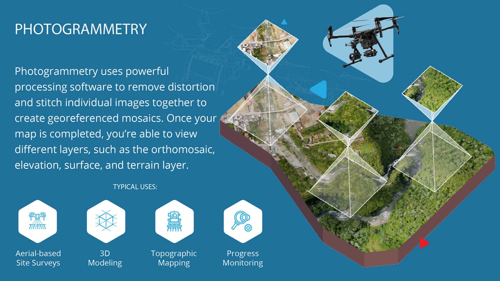
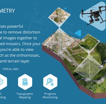
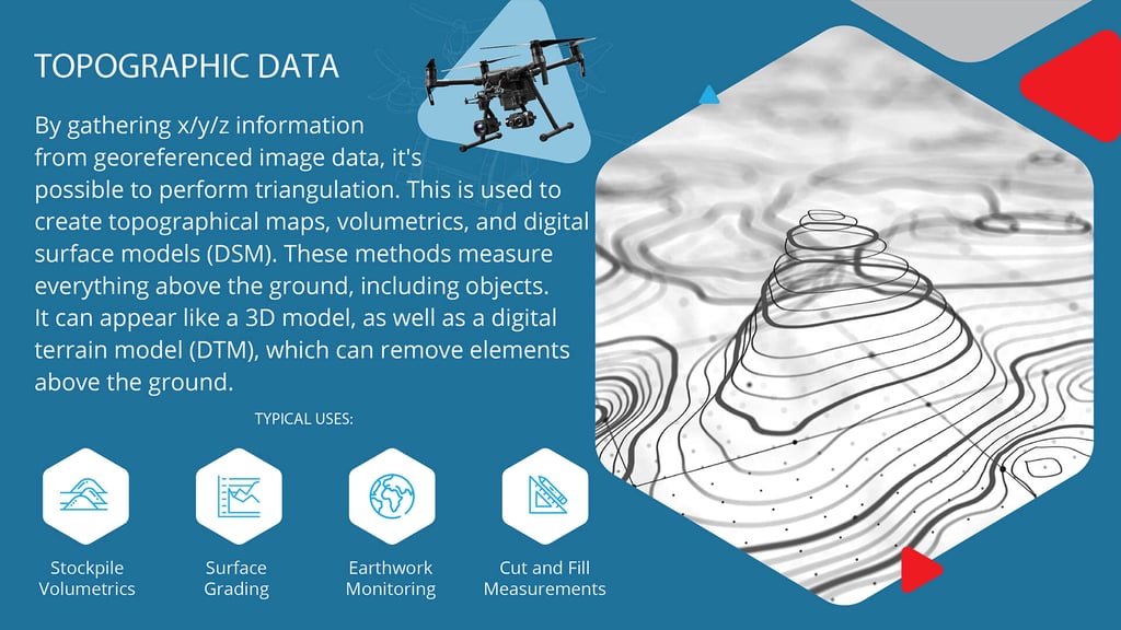
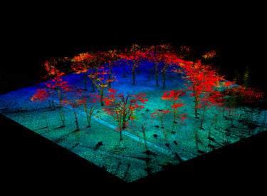
How Terrain Data Is Created
Elevation Analysis (Height Map)
An elevation analysis uses color to represent changes in height across the site, allowing terrain, vegetation, and structures to be quickly compared by relative elevation. Higher areas appear in warmer colors, while lower areas are shown in cooler tones.
This view is useful for understanding slope, drainage direction, and vertical relationships at a glance. It complements contour drawings by making elevation differences immediately visible, especially during early planning and client discussions.
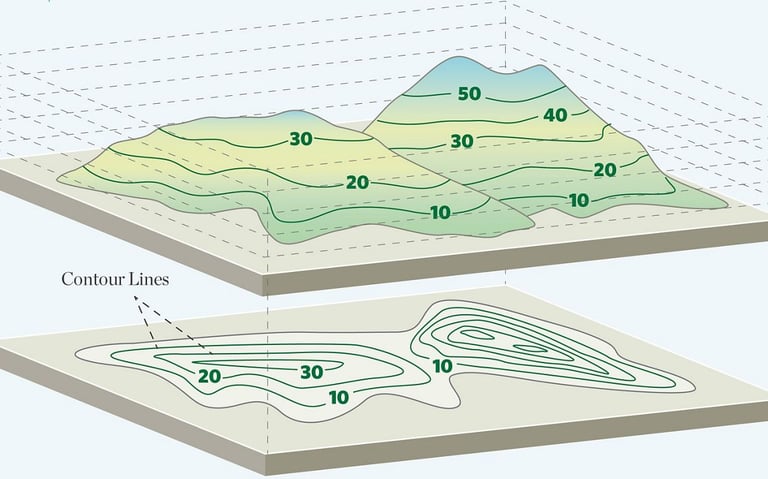
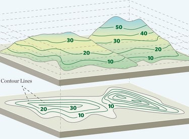

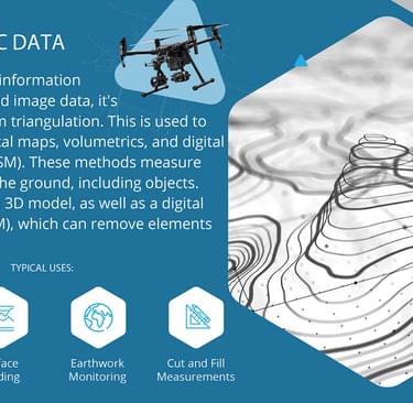
Topographic Contour Plan
A topographic contour plan represents the site using measured elevation contours, clearly showing changes in height, slope, and landform across the property. Contour intervals are selected based on site scale and complexity to ensure clarity and usefulness for design.
This plan is essential for landscape design, water features, grading, drainage, and construction planning. It allows projects to respond accurately to the natural terrain, reducing guesswork and helping avoid costly design or earthworks issues later in the process.
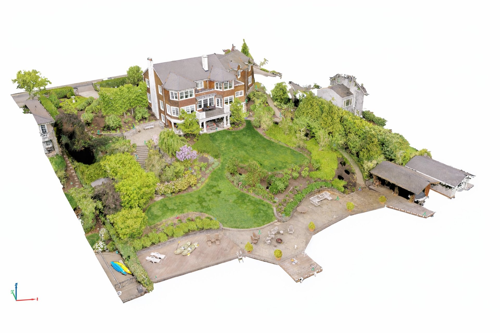
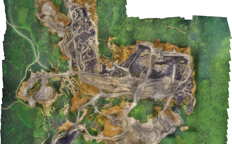
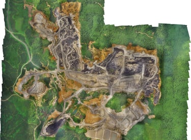
Existing Conditions Site Plan
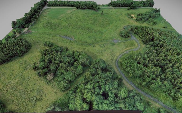
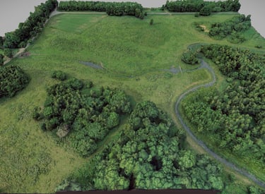
An existing conditions site plan provides a precise, bird’s-eye view of the site as it currently exists. Generated from high-resolution drone imagery, this plan shows terrain, vegetation, structures, access paths, and surrounding context at an accurate scale.
This plan is used for early planning, site understanding, and design coordination. It helps clients and designers quickly grasp spatial relationships, constraints, and opportunities on the land, making it an ideal foundation for concept design and feasibility discussions.
3D Terrain Model
A 3D terrain model translates the site’s elevation data into a three-dimensional representation that can be viewed from multiple angles. Generated from the same survey data, it provides a clear visual understanding of landform, slope, and elevation relationships.
This model is especially valuable for client communication and design decision-making. It makes complex topography easier to understand, supports discussions around grading and access, and helps visualize how proposed elements will sit within the landscape before construction begins.
Plan Types
How the Process Works
Site survey and drone flight
Data processing and terrain modeling
Plan layout and delivery
Typical turnaround: 7–10 days, depending on site size and conditions.
Pricing
When additional site areas are requested, they can be incorporated into the overall scope when defined in advance. Additional areas added later are typically priced from €400–€600, depending on size and complexity. Larger total site areas may require a scope adjustment.
All tiers include:
Site orthomosaic, topographic contours, elevation/height map and interactive 3D terrain model.
Travel & Distance
Travel within 25 km (one way) is included.
Additional travel is charged at €1.10 per kilometer (round trip).
Highway tolls are billed at cost.
Expanded Scope & Additional Areas
How This Fits Into the Design Process
The Topographic Site Plan is often the first technical step before concept design. It provides the terrain intelligence needed to explore options, test ideas, and define what is realistically possible on a site — helping avoid uncertainty and revisions later in the process.
Request a Topographic Site Plan
If you’re considering a landscape, pool, or site-based project, a topographic site plan provides the foundation for informed design decisions.
Pricing assumes standard photogrammetry (non-LiDAR) and clear flight conditions. Custom scopes quoted as needed.
Small Site
Up to 2,000 m²
€800 – €1,100
Ideal for small residential plots, early feasibility studies, or concept planning.
Medium Site
2,000 – 5,000 m²
€1,200 – €1,500
Most common scope. Suitable for detailed site planning, grading studies, and design coordination.
Large Site
5,000 – 15,000 m²
€1,600 – €2,400
For larger properties, multi-zone landscapes, or early-stage development planning.
Living water, by design.
© 2026 Valemora LDA. Aqua Vitae Pools is a trademark of Valemora LDA. All rights reserved.
Offices
Lisbon, Portugal
San Francisco, California